
Since receiving an ESRI Shapefile of the Charlottetown zoning map I’ve been experimenting with different ways of looking at and publishing the information in it. Here, for example, is a map showing all the areas in the city that are zoned “Open Space”:
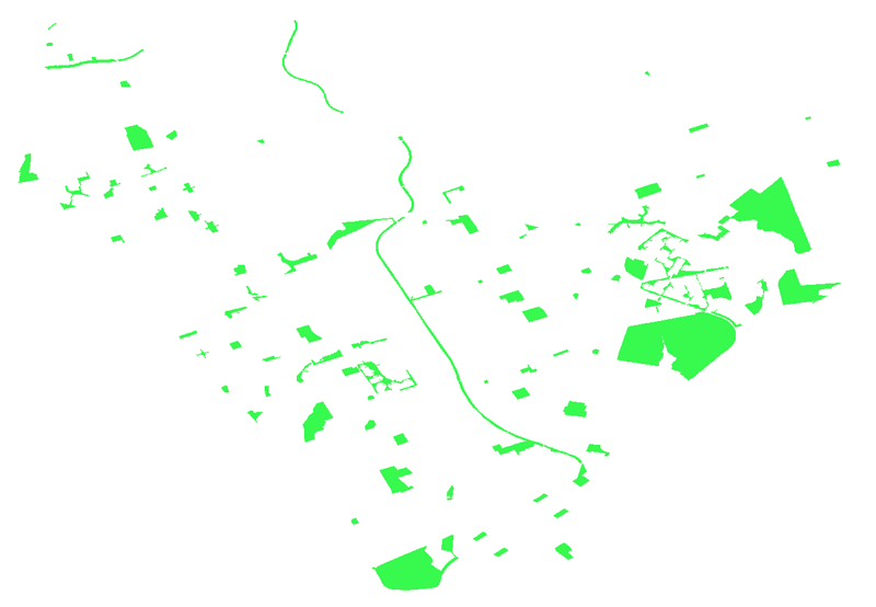
I generated this map using the open source MapServer GIS tool to create a WMS server that I then displayed using the excellent Leaflet JavaScript library. I’m working my way through the process of re-learning GIS fundamentals so that I can reproject this map over top of an Openstreetmap of Charlottetown; in the interim, standalone it’s an interesting way to visualize how much (or how little) parkland we have. Permitted uses under this zoning are:
- active and passive recreation;
- band shell;
- Campground;
- curling Club;
- Golf Course and driving range;
- Officers Club;
- Open Space;
- Park;
- pavilion;
- Public Park;
- public recreation centre; and
- trails and fields.
Here’s the same map, but only showing parcels zoned “Institutional” (cemeteries, fire halls, hospitals, libraries, and so on):

I’ll continue to plug away at this. In the meantime, the easiest way to experiment with this information yourself is to grab this KML file of the zoning map and load it into Google Earth.

Comments