
Download the ESRI Shapefile version of the lots from the PEI GIS Catalog and open the resulting lot_township_polygon.shp in QGIS.
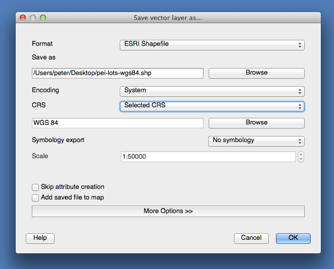
In QGIS, right-click on the layer in the layer browser, and select:
- Format: ESRI Shapefile
- Save as (filename): pei-lots-wgs84.shp
- Encoding: System
- CRS: Selected CRS (then click Browse below, and select WGS 84)
Your “Save vector layer as…” dialog should look something like this:
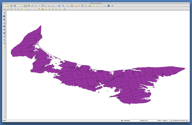
Close and reopen QGIS and open the newly-created pei-lots-wgs84.shp file, which should look like this:
If you save this as a GEOJSON file at this point, because it’s a very-detailed map the size of the file will be multi-megabytes. We want to create a smaller file, by simplifying the geometer of the lots.
To do this, select Vector menu > Geometry tools > Simplify geometries in QGIS, enter a new file name, pei-lots-wgs84-simplified.shp, using the default tolerance of 0.0001 and click OK to process.
The result will be a new, simpified Shapefile that you can now export to a GeoJSON file; load the new, simplified layer, then right-click on the layer in the layer browser, and select:
- Format: GeoJSON
- Save as (filename): lots.geojson
- Encoding: System
- CRS: Layer CRS
You can load the resulting GeoJSON file into geojson.io – it’s about 1.9MB.

Comments